


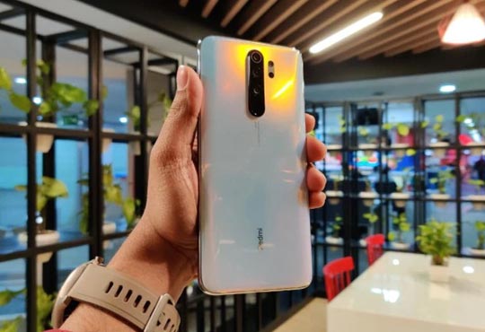
Xiaomi To Use ISRO's NavIC Technology In Its Upcoming Smart Phones
CIOReviewIndia Team | Thursday, 27 February 2020, 09:21 IST
IRNSS, the indigenous version of GPS system developed by ISRO that is said to be more accurate than current GPS is gaining a lot of attention from the industry. ISRO recently collaborated with Qualcomm to help the company provide better navigation services using the NavIC (operational name of IRNSS) in India and the surrounding regions. Qualcomm currently provides NavIC on their Snapdragon chipsets across mobile, automotive and the Internet of Things solutions in India. And now Xiaomi, one of the most popular Chinese mobile brands in India is collaborating with ISRO to leverage NavIC technology in its smart phones.
Extending its commitment to ‘Make in India’, Xiaomi is incorporating NavIC into its smart phones. This helps Xiaomi enhance the geo-location capabilities of its smart phones to provide better navigation services in India and the surrounding regions. "We are extremely proud of the sophisticated geo-positioning tech which ISRO has devised, and even more proud to integrate it into several Xiaomi devices. We also thank our partner Qualcomm Technologies for enabling support in their chipsets as we bring it first to the Redmi smart phone this year,” Manu Jain, Managing Director of Xiaomi India said in a statement.
Expressing his happiness over Xiaomi’s initiative to use IRNSS (Indian Regional Navigation Satellite System) technology across its mobile platforms, ISRO Chairman Dr. K Shivan said that ISRO was looking forward to extend the benefits of this indigenous solution to millions of Indians through such initiatives. He also thanked Qualcom for enabling NavIC technology on their chipsets.
Better Navigation Services across India and Surrounding Regions
IRNSS provides accurate and real-time positioning in India and 1,500 km from the borders including the counties of Nepal, Myanmar, Bhutan, Sri Lanka, etc. With its seven satellites NavIC has the ability to provide location with accuracy up to 20 metres. As NavIC uses dual-band frequency, it provides relatively better accuracy than conventional GPS system that uses single-band frequencies. NavIC provides easy access of location in all map-based apps like Google Maps. NavIC enables GPS technology in terrestrial, aerial and marine navigation, and helps in disaster management, vehicle tracking, fleet management, along with visual and voice navigation for drivers.
CIO Viewpoint
Why Foolproof Facial Recognition Is Key Against...
By Joseph Sudheer Thumma, Global CEO & MD, Magellanic Cloud

National Technology Day 2025: Powering Progress...
By CIOTech Outlook Team

Aligning IT Roadmap with Business Objectives: A...
By Subhash singh Punjabi, CISO & Head Enterprise Architecture, Deepak Fertilisers & Petrochemicals Corporation Ltd
CXO Insights

Three Pointers To Warehouse Transformation
By Aik Jin, Tan, Vertical Solutions Lead, Zebra Technologies Asia Pacific

Supply Chain Resilience: Managing Uncertainties...
By Sudipta Ghosh, Partner and Leader- Data & Analytics, PwC India

Site Reliability Engineering - Smart Way Of...